Directions to Battle Creek Lakeview High School
15200 Helmer Rd S, Battle Creek, MI 49015
Distance from PNHS 21miles (about 25 minutes)
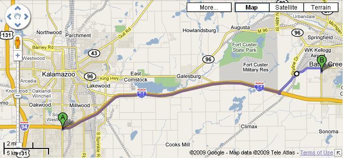
The most direct route involves taking I-94 to Helmer Rd and then north to school (see last year's map). But with I-94 eastbound lanes being closed at the Riverside Ave bridge as of Sunday, traffic may still back up at the detour off at Capital Ave, and it is recommended we get off the highway at Columbia Ave. If you find out traffic is backing up further west, it may be better to get off at 35th St and go through Galesburg and Augusta to Dickman Rd, but that takes an extra 13 minutes under normal conditions so with a 10-minute delay on I-94 it's still quicker to stay on I-94 to Columbia (or Helmer if you like to gamble).
1. Take I-94 east toward Detroit and continue 16 miles from Westnedge
2. Take exit 92 toward Springfield/Battle Creek 0.3 mi
3. Merge onto I-94 Bus/Mercury Dr, then continue to follow I-94 Bus (1.5 mi
total)
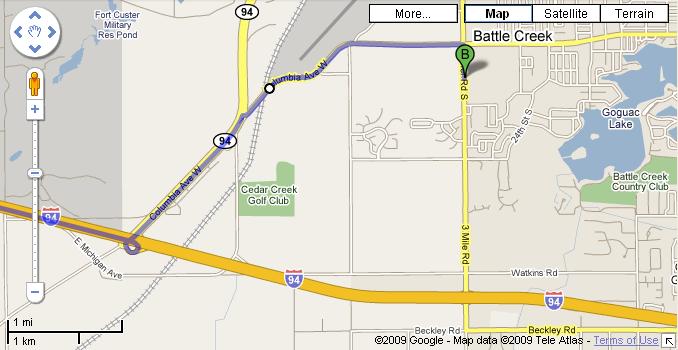
4. Turn right at Columbia Ave W and continue 2.2 mi
5. Turn right at Helmer Rd S and go south 0.3 mi
6. The entrance to the school is on your left just north of the school. Continue
in most of the way and the soccer/football field is a short walk northeast from
the parking
click on any map below to open a GoogleMaps or LiveSearch
map that you can zoom and pan around on