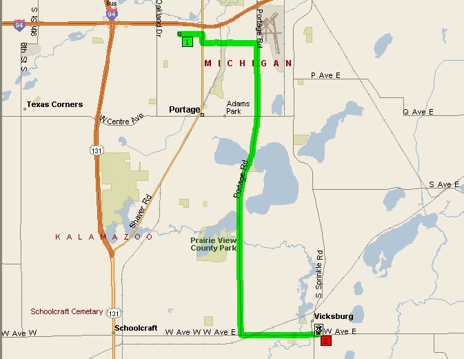
Directions to Vicksburg High School (501 E. Highway St, Vicksburg)
Via US-131 South or Oakland Dr or Portage Rd (as shown below)
1. Go south to W Avenue and turn left (east). Remember Oakland only goes to VW so you have to jog east to 16th or 18th or Portage before continuing south to W Ave.
2. Continue east on W Ave through Vickburg where it becomes Highway Street and the High School is on the north (left) side of the road between Richardson and Wilson.
Distance from Portage Northern High School is 12.7 miles and travel time is ~20-25 minutes
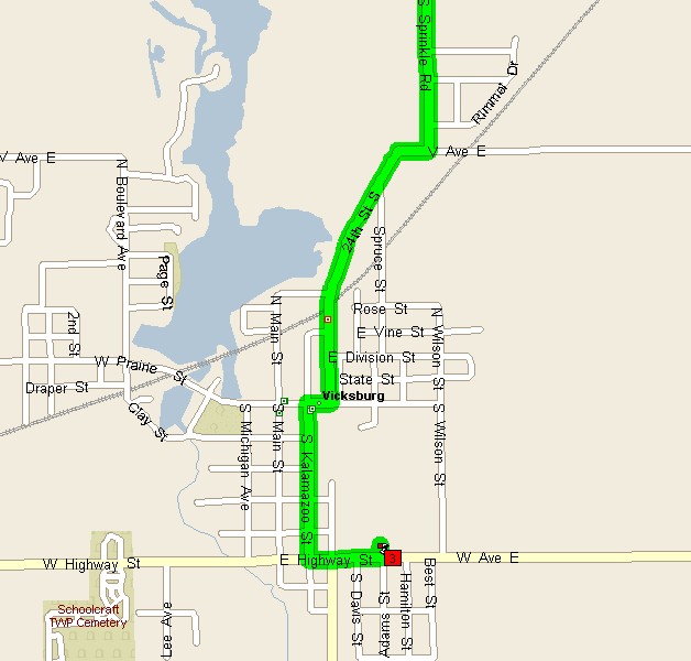
Via Sprinkle Road
1. Go south on Sprinkle Rd to V Avenue and turn right.
2. As V Ave curves left and turns into 24th St right away, you can either follow the map below, or follow the directions given on the nice 1-page map provided by Vicksburg Public Schools and described below:
3. Turn left on Spruce St.
4. Continue south on Spruce to Rose St and turn left again.
5. Continue east a short distance on Rose and it curves right into Wilson St.
6. Continue south on Wilson to W Avenue and turn right.
7. Continue west a short distance on W Ave and the school is on your right.
Distance from Portage Northern High School is 12.1 miles and travel time 20-25 minutes.
To see Google Map (aerial view) click here, the soccer/football field is just east of the tennis courts and south of the baseball field..